GeoReports is committed to responsible use of Open and Shared Data and providing a high level of data governance which meets the following goals:
- Abides by the 6 Principles of the Open Data Charter;
- Satisfies the principles of the NSW Government Standard for Data Quality Reporting Framework (October 2015, V1.2); and
- Meets ODI Bronze Level Certification which is a mark of quality and trust for open data.
More general information about data governance and responsible data re-use, is available at through the Open Data Institute (ODI).
The Dataset upload process consists of 4 main steps which typically take about 5-10 minutes to complete. More information about the intellectual property and copyright considerations for sharing data through GeoReports is available on the Copyright Guidelines page.
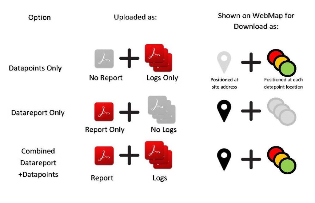
As shown in the graphic below, datasets uploaded to GeoReports can comprise individual Datapoints (boreholes, test pits, other point data), Datareports (factual or interpretive), or combined Reports with Logs which will be split out by GeoReports after upload to enable download of individual points.

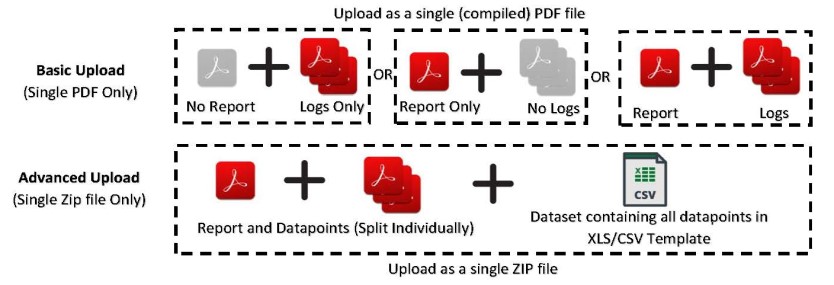
Once Dataset details are entered by the uploader into the upload form (link below), there are two main upload formats (Basic and Advanced) as shown in the graphic below:

Additional information about the Data Quality Framework applicable to all public datasets served through GeoReports is contained in our Data Quality Framework
Royalties paid for open or shared data re-sold through GeoReports are as follows:
- Submitted as Basic Upload (requiring more processing by GeoReports): Upto 15% of sales
- Submitted as Advanced Upload (requiring less processing by GeoReports): Up to 30% of sales
Additional information about the data pricing, royalties and commercial considerations involving multiple Interested Parties are explained here.
